Ocean heat causes much of the ice loss
in Greenland and Antarctica

I use satellite measurements, machine learning, cloud-computing, and open science to build
a better understanding of glacier and ocean change in Greenland and Antarctica and impact on the planet.

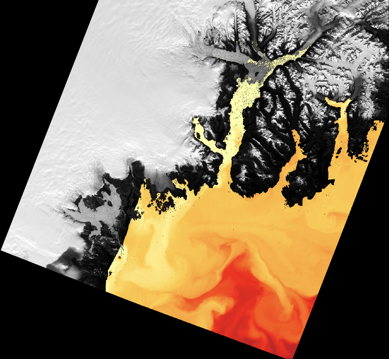
Glacier ocean systems through
the lens of thermal infrared (heat)

Satellites capture thermal images of the ocean and ice in polar regions. We use thermal in new ways to study ocean circulation, ice melt, and to see ice features in polar winter. Learn more.

Open science as a process,
not a product

As ice and ocean data volumes grow with new techonlogies, cloud infrastructure and open-source science values will help scientists maximize research innovation and societal impact. Learn more.

Responsible, open-source AI

We help researchers and data producers learn how to minimize risks in the AI tooling they design and we help build and test new open-source infrastructure that harness AI for science enablement. Learn more.

About me

Check out my Curriculum Vitae to learn more!